Most Popular
-
1
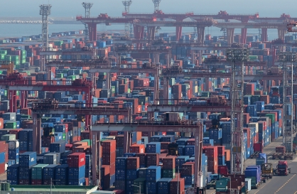
Exports to US reach all-time high, widen gap with China
-
2
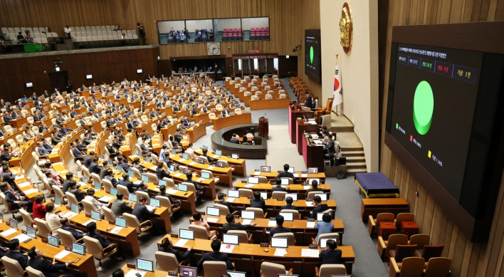
Trump rekindles criticism: US forces defending 'wealthy' S. Korea 'free of charge'

-
3
[Music in drama] Rekindle a love that slipped through your fingers
![[Music in drama] Rekindle a love that slipped through your fingers](//res.heraldm.com/phpwas/restmb_idxmake.php?idx=644&simg=/content/image/2024/05/01/20240501050484_0.jpg&u=20240501151646)
-
4
S. Korea discussed possible participation in AUKUS Pillar 2 with Australia: defense minister

-
5
[New faces of Assembly] Architect behind ‘audacious initiative’ believes in denuclearized North Korea
![[New faces of Assembly] Architect behind ‘audacious initiative’ believes in denuclearized North Korea](//res.heraldm.com/phpwas/restmb_idxmake.php?idx=644&simg=/content/image/2024/05/01/20240501050627_0.jpg&u=20240502093000)


![[Music in drama] Rekindle a love that slipped through your fingers](http://res.heraldm.com/phpwas/restmb_idxmake.php?idx=644&simg=/content/image/2024/05/01/20240501050484_0.jpg&u=20240501151646)

![[New faces of Assembly] Architect behind ‘audacious initiative’ believes in denuclearized North Korea](http://res.heraldm.com/phpwas/restmb_idxmake.php?idx=644&simg=/content/image/2024/05/01/20240501050627_0.jpg&u=20240502093000)
-
6
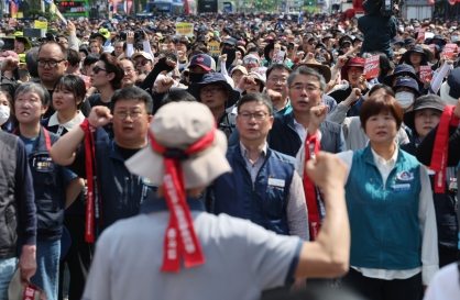
On May Day, labor unions blast Yoon's foreign nanny proposal
-
7
Seoul Metro to seek legal action against malicious complaints

-
8
[KH Explains] Will alternative trading platform shake up Korean stock market?
![[KH Explains] Will alternative trading platform shake up Korean stock market?](//res.heraldm.com/phpwas/restmb_idxmake.php?idx=644&simg=/content/image/2024/05/01/20240501050557_0.jpg&u=20240501161906)
-
9
Illit, mired in controversy, remains on Billboard charts for 5th week

-
10
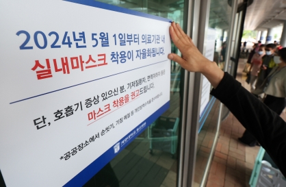
S. Korea lowers COVID-19 warning level, lifts last-remaining antivirus mandates


![[KH Explains] Will alternative trading platform shake up Korean stock market?](http://res.heraldm.com/phpwas/restmb_idxmake.php?idx=644&simg=/content/image/2024/05/01/20240501050557_0.jpg&u=20240501161906)


Unusually powerful typhoon to batter Korean Peninsula
By Korea HeraldPublished : Aug. 27, 2012 - 09:23
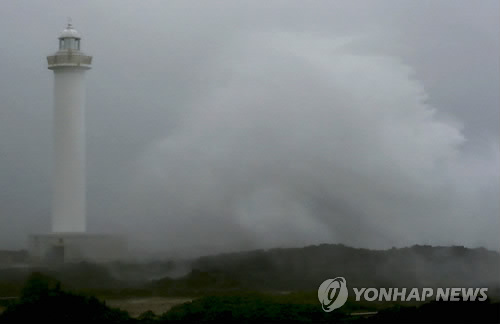
The most powerful typhoon in a decade is set to hit the Korean Peninsula early this week, weather forecasters said Sunday, prompting authorities to brace for a worst-case scenario.
Typhoon Bolaven, which is named after a highland region in Laos, was moving northward at a speed of 15 kilometers per hour from southeastern waters off Japan‘s Okinawa as of 3 p.m., according to the Korea Meteorological Administration (KMA).
The typhoon is expected to approach waters some 500 kilometers off South Korea’s southern island of Jeju early on Monday, and then transit near the country‘s west coast before making landfall near Sinuiju, North Korea, on Wednesday.
The storm is large in scale with a central pressure of 920 hectopascals and a maximum wind speed of 53 meters per second, the KMA said, adding it is expected to stay at that strength until at least late Tuesday.

“We classify a typhoon with a maximum wind speed of more than 44 meters per second as ’super strong,‘ which can move not just people but big rocks,” a KMA official said.
“Moving along the west coast, the typhoon could weaken a little, but it’s moving closer to the peninsula than previously thought and could deal a serious blow,” he added.
Heavy downpours and gale winds are expected to start on Jeju Island and the southern part of the country late Monday, it added.
The most fatal typhoon this decade in South Korea was Typhoon Rusa in 2002. After making landfall on the southern part of the country with a central pressure of 965 hectopascals and a maximum wind speed of 33 meters per second, the typhoon caused 246 deaths and 5.1 trillion won (US$4.49 billion) in property damage, government data showed.
To brace for what may be the country‘s worst storm, authorities said they are conducting safety inspections of areas prone to landslides, cordoning off dangerous areas such as seawalls and beaches, and encouraging people living in vulnerable regions to evacuate beforehand.
“All regional governments should make every effort to prevent casualties possibly caused by the forthcoming typhoon,” Maeng Hyung-kyu, minister of Public Administration and Security, said during a conference call with regional leaders in the day, instructing them to “maintain full preparations against the typhoon and swiftly support victims in case of any disasters.”
In mid-July, Typhoon Khanun passed through the country, resulting in the death of one person and causing hundreds of passenger services to be canceled. (Yonhap News)
<관련 한글 기사>
태풍 ‘볼라벤’ 대비, 비상근무 ‘최고단계’!
앙재난안전대책본부는 전국이 북상하는 태풍 볼라벤의 직접 영향권에 들어갈 것으로 예상됨에 따라 27일 오후 3시를 기해 관련 중앙부처와 기관의 비상근무 체계를 최고단계인 3단계로 격상했다고 밝혔다.
이에 따라 23개 관련 부처와 기관이 중대본에 파견돼 비상근무에 돌입했다.
중대본은 또 전 지방자치단체에서는 모든 행정력을 동원해 태풍 대응에 전력을 기울이라고 긴급 지시했다.
맹형규 행정안전부 장관은 "산사태 우려 지역과 급경사지 등 인명피해 우려 지역에 대해서는 예찰을 강화하고 위험 징후시 주민들을 사전에 대피시키라"고 강조했다.
또 "태풍으로부터 피해를 입지 않도록 외출을 자제하고, 강풍으로 파손될 우려가 있는 유리창에는 젖은 신문지나 테이프를 붙여달라"고 국민들에게 당부했다.
-
Articles by Korea Herald